TRIP REPORT: Point-to-Point Trek Up and Over Kinsman Ridge is not a “Traverse” – by Ham Mehlman
January 8, 2025
Posted in
Ham Mehlman is Editor-in-Chief of Mountain Passages and an AMC-NH member. He skis, hikes and bikes New Hampshire’s backcountry, trails and byways when time allows.

My route
Probably 99.999% (9,999/10,000) of hikes in the White Mountains of NH are day hikes. I’m not quoting any survey or study here and would not be surprised if the percentage is even higher. And probably 99.999% percent of those are “out and backs” or maybe loops. The logistics are just so much easier and more sensible. Park your car at the trail head and return there. Pretty basic. Point-to-point excursions or “destination” hikes require some planning – either dropping a second car (or bicycle) at the other end or organizing a pickup or sticking out a thumb. And often the points are pretty far apart (8-20 miles) making for big days, only appealing to a few enthusiasts. Some of the classic point-to-point routes hike the length of ridge lines and are pretty long. Going across a ridge line can be a lot shorter, as the crow flies, but can make for long logistics at the end of an arduous day. For example, you could hike up and over Mt. Washington from Pinkham Notch and descend down one of the trails on the Ammonoosuc side – a reasonable eight or so miles as the crow flies – but 42 miles driving via Rts. 16 and 302. There are, however, a few areas with access running parallel on both sides of a ridge or a mountain that make for interesting, minimally masochistic days, some that are reasonably accessible to an average hiker and could change up the typical hiking experience.
Up for a new challenge, having hiked most of the out-and-backs and loops in my neck of the woods, Franconia Notch, a friend and I plotted a very doable clamber over the Kinsman Ridge. Of course my friend ultimately bagged, leaving me to plot and hike this adventure on my own. Eventually, I chose to start at the Basin in the Notch, hike up Basin-Cascade to Lonesome Lake, hike Fishin’ Jimmy to Kinsman Ridge and down the Kinsman Trail to the Rt. 116 trailhead with options for tagging North and South Kinsman peaks (4,293 ft and 4,358 ft). The AMC 4,000-footer club recognizes both peaks on its 4,000-footer list. AllTrails maps the route as 8.4 miles with approximately 2,400 ft of elevation gain, fairly modest compared to some other hikes of similar length. And the direction of a point-to-point matters: trekking the opposite direction here, starting at Rt. 116, adds 900 feet of vertical to the outing.
Initially, I referred to my little project as a “traverse”. In common parlance, we/I often use the term to describe “crossing” something. Merriam-Webster seems to agree. So it seemed reasonable to refer to my hike as a “traverse” of the Kinsman Ridge. Unh unh. It turns out that various disciplines of mountaineering have differing ideas of what “crossing”, and therefore “traversing”, might mean and have coopted differing interpretations for their own jargon. For example, in technical mountaineering (rock climbing), “a traverse is a section of a climbing route where the climber moves laterally (or horizontally), as opposed to in an upward direction.” Perhaps the most famous technical mountaineering traverse is the Hinterstoisser Traverse in Switzerland, first managed in 1936, which eventually enabled the first successful ascent of the North Face of the Eiger in 1938. (Andreas Hinterstoisser himself tragically plummeted to his death trying to climb back across the eponymously named “traverse”.) Thankfully, ascending to Kinsman Ridge from the floor of Franconia Notch does not remotely compare to ascending the North Face of the Eiger. In fact, there is nothing remotely technical about it (except for a bit of scrambling) so this connotation of “traverse” need not apply. In trekking or hiking, “traverse” is used to describe or label “going along” a path, an activity also consistent with Merriam Webster’s various uses of the term. So, same word, different connotations. In the Whites and most areas of the world, cartographers use “traverse” to refer to going along a path with the paths of interest here referring to ridges. In describing my little project to a knowledgeable hiking buddy, “traversing the Kinsman Ridge” then specifically means a hiking the length of the 16+ mile Kinsman Ridge Trail described as “one of the longest, toughest, but most rewarding ridge lines in the White Mountains.” Not my intent nor plan. In fact, there are a number of traverses touted as terrific point-to-point hikes in the White Mountains. But they are generally better suited to young masochists with 2% body fat and willing to risk hiking in the dark.
The grandiestdaddy of traverses in the Whites is the Presidential Traverse, described as 19-23 miles with about 9,000 feet of elevation gain “traversing” seven 4,000-footers and a couple of other peaks that are close. It’s a day hike only for some. With hike times variously reported as 10 hours of moving time for the rabbits and up to 18 hours for those making a mistake. One site tries to quantify an estimated time concluding that, “If you can maintain a ‘book time’ pace, it will take you 14 hours to hike a 19.55 mile Presidential Traverse with 8,300 feet of elevation gain.” They define “book time” or “Naismith’s Rule”, as “the minimum time that it would take an inexperienced hiker to complete a trail segment. It’s based on the following metric: 30 minutes for each mile of distance or 1,000 feet of elevation gain.” These qualify as destination, point-to-point excursions, but were more than I was looking for.
So I couldn’t call my plan a “traverse”. A “crossing” seems accurate enough but sounds like I’m fording a river or standing at the corner of 59th and 5th in New York City. How about “up-and-over”, descriptive if a bit awkward? Hopefully some linguist will provide a more specific and better term. But for this article, it’s an “up-and-over”.
Per protocol for any hike and most outdoor activities in general, on the morning of October 8, I checked the local forecast from Weather.com. Not bad – generally overcast with temps rising to mid 50’s with risk of rain late in day. Also per protocol for hiking, I checked Mt. Washington Observatory’s (MWO) “higher summits” forecast: “A large, deep upper-level low will bring unsettled weather for much of the forecast period as well as the higher elevation’s first sustained stretch of below-freezing temperatures and wintry precipitation since the spring. On Tuesday morning, the upper-level low is currently centered over western central Quebec….” In a nutshell:
“Tuesday:
Mostly in the clouds under mostly cloudy skies with a chance of upslope snow showers. Possible snow accumulations of a trace to 1 inch.
- High: Around 30 [0F.]
- Wind: NW shifting W at 30-45 mph w/ gusts up to 55 mph early decreasing to 20-35 mph w/ gusts up to 45 mph
- Wind Chill: 0 to 10 above rising to 5 to 15 above”
Gee I hope that air all stays above me. “Freezing levels will begin Tuesday morning around 4,000 feet and retreat upslope to around 5,500 feet during the day.” I guess so. Ridge sounds like it might get some wind… But it’s an “up-and-over:” exposure should be brief.
Feeling extremely confident about the weather I threw gloves, hat, boot cables and two extra shirts into my 32L pack. At least it looked full.
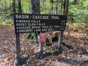 My car service, in this case, a very kind, if a bit concerned, spouse, dropped me at the Basin around 9:00 am. After finally locating the trailhead on the backside of the maze of paths, the Basin Cascade Trail led me up the right bank of Cascade Brook at a pleasant grade. I immediately noticed the brook was frolicking and yapping, a bit surprising after a relatively dry stretch of weather. Clearly some upslope showers had added a bit of flow overnight. For me, the sight raised a red flag. Back in May I had hiked a loop ascending the Lonesome Lake Trail from Lafayette Place with the intent of descending Cascade Brook Trail. Between snow melt and substantial rain, Cascade Brook resembled a class V rapid. For those familiar with the trail you know that the trail crosses the “brook” about a mile from Lonesome lake. Years ago there was a bridge here. But it washed away at some point never to be replaced. Even at low water the crossing seems tricky, particularly if rocks are wet after a rain. At higher waters it definitely is not for the faint of heart, requiring world record broad jumps between rocks of different heights and a prayer that you’ll stick the landing on the slippery surface on the far side. In May, I was not up to the challenge and opted to bushwack down the left bank. That little detour added an hour or so to the loop and realization that it might be years before anyone came across me if I broke a leg scampering through the old growth forest.
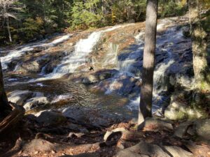
Scenic falls on Cascade Brook
The increased water volume should have clued me that I was on a collision path with “Murphy’s Law” -“Anything that can go wrong will go wrong.” On this adventure I had a full-on visit with Mr. Murphy at my favorite crossing spot. The most apparent path required a leap from a low rock across an uncomfortably wide gap with an uncomfortably large flow of water rushing through to an elevated, very wet turtle back platform about 18 inches in diameter. I chickened out and looked for an alternative. Slightly upstream on the far side of a large boulder there seemed to be a nicely arranged series of rocks all about the same level if I could only get there. Just needed to negotiate the large boulder with one of the steps on the far side. But it was a blind step requiring gripping the boulder and finding the step with your foot. I never found it. Grip slipped, foot missed step and body, most of it, found water. Not a good start to a day with an iffy temperature forecast. On the other side I took inventory of my condition. My pack kept its contents dry but I only had packed a couple of extra shirts and a rain coat, not anticipating swimming in the brook. Most of my kit was technical and would dry with time except one key article I won’t reveal. And let’s just say, Gortex is a great boot material for keeping your feet dry but you need to keep the water on the outside. Gortex is also remarkably good at holding water in the boot when you fill it. So very wet boots. Even if I had a dry pair of socks my feet were going to be wet the rest of the day.
Assessing my greeting by Mr. Murphy, in a bit of shock, I considered bailing (no pun intended) on my little adventure. Perhaps best left to another day. If the route down had been easy and I had transportation waiting I probably would not have hesitated. I was that discouraged. But I had no appetite for crossing back across Nasty Brook and I don’t like admitting defeat, particularly when I’m touting this route as a relatively modest tour in the Whites. So I thought at the least I would hike to Lonesome Lake, 1.3 miles according to the sign. At Lonesome Lake I could take advantage of the Lonesome Lake AMC hut to dry out a bit and reassess options including hiking down via Lonesome Lake Trail to Lafayette Place.
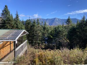
View from Lonesome Lake hut
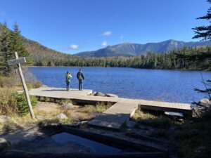
Lonesome Lake looking toward Mt. Lafayette
My wounded pride recovered a bit with time on the trail; the shock wore off. More importantly, the technical articles of clothing excepting my socks swimming in water in my boots, dried fairly quickly and the temperature seemed to rise with little evidence of the wind that the Mt Washington Observatory seemed so certain of. The refuge of the hut was wonderful. I even bought a pair of socks so my feet would only be damp and not squish with every step. The sun peered out a bit and the ridge beckoned only two miles on. I was back in the game, still a bit damp but with restored mojo.
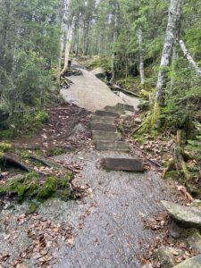
Stairway to…
Fishin’ Jimmy is a New England classic and a segment of the Appalachian Trail (AT). Its 1.8 miles in length with a rise of about 1,100 feet. But the first half is pretty much a level hoof through dense forest with all the rise coming at an average 30-35 degree angle with a few 50 degree pitches on the back end. Ladders, wood steps (photo) and metal rungs assist but nothing helps the quad burn or stops the heart from racing at 15 bpm. Being an AT segment and peak leaf peeping season I expected pushing, shoving mobs even on a Tuesday. Nope. I guess others heeded the Mt Washington Observatory forecast. In fact pretty much the only folks I ran into all day was a US Forest service crew working on top of the ridge and the Kinsman Trail down to Rt. 116. It is true that views are limited, a brief window from the top of the ridge (photo). Had I detoured along the ridge to the summits of North Kinsman I would have found better views. The view from North Kinsman is just a ledge outcrop just off the summit but the South Summit features 360 (degree) views.
But with my wet butt and damp socks I stuck to the up-and-over plan and was not anxious to explore. Fortunately Weather.com was more correct than MWO, at least on Kinsman Ridge. Almost no wind and temps in the 50’s. My wet butt and damp socks simply kept me cool. But still, I didn’t linger on the ridge, hurrying off the ridge down Kinsman Trail. The decent to 116, peaceful, if not a bit boring. Wooded the entire 3.9-mile length, descending at a modest grade with few notable obstacles, if any, and lightly trafficked even on the best of days. But I had had enough adventure for one day, please with my achievement and hoping to avoid another rendezvous with Mr. Murphy again anytime soon
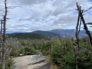
Top of Kinsman Ridge, my high point